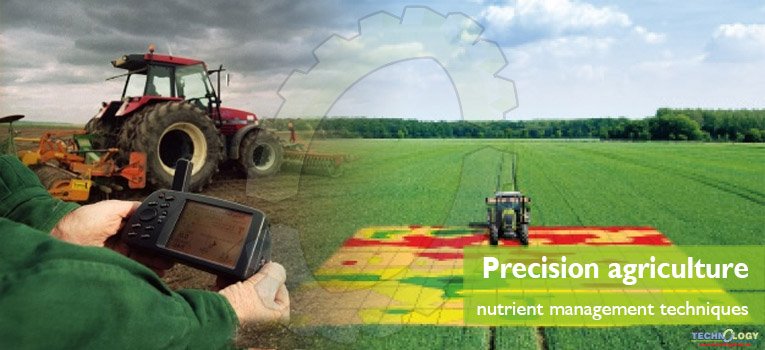
Precision agriculture (PA) is an approach to farm management that uses information technology (IT) to ensure that the crops and soil receive exactly what they need for optimum health and productivity. The goal of PA is to ensure profitability, sustainability and protection of the environment. PA is also known as satellite agriculture, as-needed farming and site-specific crop management (SSCM).
Innovative techniques used in PA
- Sensors: Sensors in fields measure the moisture content and temperature of the soil and surrounding air.
- Remote sensing: Remote sensing can be divided into three categories: ground-based, airborne and satellite.
- Ground Based Remote Sensing: According to Jackson (1986) handheld remote sensing instruments are very useful for small-scale operational field monitoring of biotic and abiotic stress agents. Ground level remote sensing methods are also used to determine the nutritional requirements of plants.
- Airborne Remote Sensing: Obtain very high resolution imagery. Allows for observation of individual plants, patches, gaps and patterns over the landscapes that have not previously been possible.
- Satellite Imagery: Satellite imagery has been used for crop type mapping, general crop condition assessment, and crop acreage estimation. Large Area is covered by it.
- Satellites and robotic drones: Satellites and robotic drones provide farmers with real-time images of individual plants. Information from those images can be processed and integrated with sensor and other data to yield guidance for immediate and future decisions, such as precisely what fields to water and when or where to plant a particular crop.
- NDVI (Normalized Difference Vegetation Index): (NDVI) quantifies vegetation by measuring the difference between near-infrared (which vegetation strongly reflects) and red light (which vegetation absorbs). NDVI always ranges from -1 to +1. But there isn’t a distinct boundary for each type of land cover.
In particular, there are several sectors that use NDVI. For example, in agriculture, farmers use NDVI for precision farming and to measure biomass. Whereas, in forestry, foresters use NDVI to quantify forest supply and leaf area index. Furthermore, NASA states that NDVI is a good indicator of drought. When water limits vegetation growth, it has a lower relative NDVI and density of vegetation.
- GreenSeeker: It is an integrated optical sensing and application system that measures crop status. The GreenSeeker applies the right amount of N at the right place and at the right time thereby optimizing yield and the crop’s nitrogen requirements.
Nitrogen Modeling
Although some forms of variable-rate fertilizer have been used for decades, nitrogen modeling has become more pronounced recently. “Our clientele has been using variable-rate technologies for fertilizer applications since the mid-1990s,” says Matt Waits, CEO for SST Software. Recently, SST Software has partnered with Agronomic Technology Corp. (ATC) to introduce Adapt-N.
According to ATC CEO Steve Sibulkin, Adapt-N was first introduced in 2014 and is becoming an important tool for properly managing nitrogen use. “There’s a belief in agriculture that today’s environmental pressures will only get worse as the industry moves forward,” says Sibulkin. “The vast of majority of growers want simple methods to use to be able to address these concerns. That’s what Adapt-N and other nitrogen modeling processes are currently bringing to the table.”
GPS soil sampling
Testing a field’s soil reveals available nutrients, pH level, and a range of other data that is important for making informed and profitable decisions. In essence, soil sampling allows growers to consider productivity differences within a field and formulate a plan that takes these differences into account. Collection and sampling services that are worth the effort will allow the data to be used for input for variable rate applications for optimizing seeding and fertilizer.
Irrigation
Innovations in precision irrigation technologies are growing even more crucial as growers face water scarcity due to drought, aquifer depletion, and water allocations. One recent advance is telemetry, says John Campbell, Manager of Technology Advancement and Adoption with Valley Irrigation.
Products now allow growers to remotely monitor and control nearly every facet of their irrigation operation. The systems save water, time, fuel, and wear and tear on vehicles.In the future, Campbell says producers will be integrating soil moisture monitoring, weather data and variable rate irrigation (VRI) into their systems.
Precision Mobile Drip Irrigation as another major advance. PC dripline is pulled through the field by a center pivot or linear move irrigation system. As the driplines are pulled behind the system, the integrated emitters deliver a uniform pattern across the full length of the irrigated area.
Computer based applications
Computer applications can be used to create precise farm plans, field maps, crop scouting and yield maps. This, in turn, allows for the more precise application of inputs such as pesticides, herbicides, and fertilizers, thus helping to reduce expenses, produce higher yields and create a more environmentally friendly operation and the inability to integrate the information they provide with other data sources to enrich and show significant value to farmers.
Agriculture control centers
Agricultural control centers integrate sensor data and imaging input with other data, providing farmers with the ability to identify fields that require treatment and determine the optimum amount of water, fertilizers and pesticides to apply. This helps the farmer avoid wasting resources and prevent run-off, ensuring that the soil has just the right amount of additives for optimum health and controlling the farm’s environmental impact.
Conclusion
In the past, agriculture (PA) was limited to larger operations which could support the IT infrastructure and other technology resources required to fully implement and benefit from the benefits of agriculture.
Today, however, mobile apps, smart sensors, drones and cloud computing makes PA possible for farming cooperatives and even small family farms.
This article is collectively authored by Muhammad Nazim*1, Qurat-ul-Ain Sadiq2, Tahira Shahjahan and Mehak Fatim 1 Department of Agronomy, Muhammad Nawaz Sharif, University of Agriculture Multan, Pakistan. 2 Department of Soil and Environmental Sciences, Muhammad Nawaz Shareef, University of Agriculture Multan, Pakistan.
