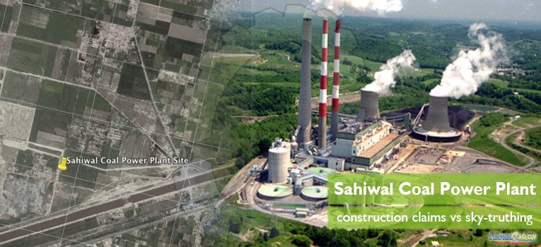
Since June 2005, Google Earth is providing 3D version of satellite imagery, helping the users to explore landscape and cities. The potential applications of this computer software offer a range of navigation options to capture geographical data. The Google Earth Pro was used to successfully monitor the constructional activities of Sahiwal Coal Power Plant, Punjab Pakistan. The tracking presents the whole constructional progress of Sahiwal Coal Plant that was initiated in Jan 2015 and completed in August 2017.

Pakistan is facing serious energy crises since 2011-12 and to overcome this shortage Pakistan is striving hard. Government of Pakistan has started many projects independently or with involvement of funding agencies in Pakistan. Sometimes it becomes difficult for common person to track progress in continuing government projects.
Google has provided a solution in the form of Google Earth which is a new source free to use. It can easily be used to identify urban vegetation, buildings, measure distances or extract any other earth science data.
China Pakistan Economic Corridor (CPEC) has opened an era of huge investments in Pakistan that is about 46 billion US$. It includes a web of roads, railways and power projects. Sahiwal coal power plant is one of those projects started in 2015 and completed in 2017.
Sahiwal Coal Power Plant is financed by Independent Power Producer (IPP) with estimated cost of 1.66 billion USD. The project was completed under supervision of Punjab Power Development Board (PPDB).
In this study Google Earth Pro is used to monitor constructional activities of Sahiwal Coal Plant.
Sahiwal Coal Power Plant study area
The study area is Sahiwal Coal Power Plant and Qadirabad Coal Fired Power Plant, Sahiwal. Location of these two power production units is about 12.3 km away from main Sahiwal city (measured using google earth ruler). To monitor constructional time lapse of the project is the main study objectives.
Material and Method
Google Earth Pro was downloaded from its official website. It was installed on window 7, HP Core i3 laptop. After installation software was ready to run. Site of Sahiwal Coal Power Plant was searched in search tab of Google Earth.
By right clicking on sidebar a new polygon was formed and a sketch was drawn estimated to covering visible boundary of site. “Show historic imagery” time lapse tab of Google Earth Pro was used to show a time lapse bar, legend was also displayed along with north arrow. Scrolling one by one, all possible clear images of Google Earth were selected, printed and edited in Microsoft Paint.
Resultant images were compiled in one images to make it easy to compare.
Results and discussion
Total of 13 images were clipped form display screen showing dates of those images. All images were cropped and compiled in one image showing time lapse of study site.
Resultant imagery clearly shows that before 02 Jan 2015 site was an agriculture land, until in June 2015, the site clearance and construction work was started. In October 2015 image, it can be seen clearly that construction work is going on. 2016 and 2017 were time year of work. Construction work can be seen in all images and construction was finally completed on August 2017.
Power plant started working on December 2017. It has supercritical technology and an installed capacity of 1320 MW.
Google earth proved very effectively in tracking progress. It can be used by official governing body and local community members to monitor constructional advancement in their neighboring areas.