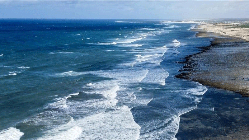
A recent study reveals that over the past 12 years, sea levels along the Southeast and Gulf coasts of the United States have been rapidly accelerating and breaking records.
A recent study reveals that over the past 12 years, sea levels along the Southeast and Gulf coasts of the United States have been rapidly accelerating and breaking records.
The study stated that rates of sea level rise have been about half an inch per year since 2010, which is three times faster than the global average for the same time period. They blame the acceleration on the interactions between anthropogenic climate change and climatic variability.
According to a recent study led by researchers at Tulane University, sea levels along the Southeast and Gulf coasts of the United States have been rapidly accelerating and breaking records over the past 12 years.
According to the study, which was published in Nature Communications, sea levels have been rising at a rate of about half an inch per year since 2010. They explain the acceleration as the result of the interaction between natural climate variability and man-made climate change.
Sönke Dangendorf, lead author and assistant professor in the department of river-coastal science and engineering at Tulane University, says that these rapid rates are unprecedented for at least the 20th century and have been three times greater than the global average over the same time.
The authors identified the specific causes of the acceleration by analysing field and satellite measurements going back to 1900. In the team led by Dangendorf at his former university, Old Dominion University in Norfolk, Virginia, Noah Hendricks is a co-author and undergraduate student.
“We systematically investigated the different causes, such as vertical land motion, ice-mass loss, and air pressure, but none of them could sufficiently explain the recent rate,” he said.
In contrast, we discovered that the acceleration is a broad signal that stretches from the Gulf of Mexico coast all the way up to Cape Hatteras in North Carolina, as well as into the North Atlantic Ocean and Caribbean Seas, and that it is indicative of changes in the ocean’s density and circulation.
This entire region, known as the Subtropical Gyre, has been growing over the last 12 years, primarily as a result of altered wind patterns and ongoing warming. Sea levels rise as a result of the need for more space created by warmer water masses.
According to the researchers, the recent acceleration resulted from the unfortunate coincidence of signals related to human-caused climate change and a peak in weather-related variability that lasted for several years. They come to the conclusion that in the upcoming decades, the rates will probably return to the more reasonable values suggested by climate models.
Torbjörn Törnqvist, co-author and the Vokes Geology Professor in the Department of Earth and Environmental Sciences at Tulane, said, “However, this is no reason to give the all clear.” Particularly in Louisiana and Texas where the land is sinking quickly, these vulnerable coastlines have been put under even more stress as a result of the high rates of sea-level rise.
As per Dangendorf, the “The findings once again highlight how urgent the climate crisis is for the Gulf region. To address these issues in a sustainable manner, we require interdisciplinary and teamwork efforts.”
Thomas Frederikse from the Jet Propulsion Laboratory in Pasadena, California, Qiang Sun from Tulane University, John Klinck and Tal Ezer from Old Dominion University, Francisco M. Calafat from the National Oceanography Centre in Liverpool, UK, and Thomas Wahl from the University of Central Florida in Orlando also contributed to the study.