IAEA Ready To Assist Interested Member States To Develop And Implement This Technology For Radiological Mapping Following Emergency.
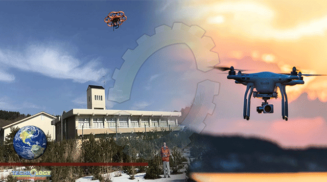
In the aftermath of a nuclear accident, such as the one at Fukushima Daiichi Nuclear Power Plant in 2011, the radiologically contaminated area in the vicinity of a reactor can be too dangerous for people to enter to monitor radiation. A new technology using drones, developed by the IAEA for use by the authorities of Fukushima Prefecture in Japan, will make this task easier.
An IAEA-developed instrumentation and methodology for Unmanned Aerial Vehicles (UAVs) equipped with radiation detectors, cameras and GPS devices has been tested and validated under real conditions in the Fukushima Prefecture in Japan and is now available for practical use in routine or emergency situations. Based on this experience, The IAEA Is Ready To Assist Interested Member States To Develop And Implement This Technology For Radiological Mapping Following A Nuclear Or Radiological Emergency.
The low cost of drones and the fact that people avoid being exposed to radiation by using them are significant advantages of this technology. The IAEA and Fukushima Prefecture first started working together on developing and applying UAVs for radiological monitoring in 2012. In the framework of the IAEA Action Plan on Nuclear Safety, the IAEA has assisted Fukushima Prefecture through two consecutive cooperation projects from 2012 to 2020 by:
- Providing a complete UAV-based instrumentation system for radiation measurements — a radiation detection system with data processing and storage capability — developed and built at the IAEA Nuclear Science and Instrumentation Laboratory (NSIL);
- Providing post-measurement analysis and interpretation methodology as well as training personnel both at Fukushima Prefecture and at NSIL in Seibersdorf, Austria on how to apply the UAV and its instrumentation system as well as on how to use the software for obtaining and interpreting data.
Recently there has been breakthrough advances in UAVs and major developments are expected in the near future, including larger payloads, integrated detectors and sensors, improved self-navigation and the ability for the vehicles to work in cooperation with other UAVs as well as ground systems. The IAEA is currently working on the integration and testing of new, improved instrumentation, including its adaptation to the next generation of UAVs.
“These novel developments will allow both longer flight time of the UAV and determination of the dose equivalent rates and gamma spectra in a single measurement,” said Danas Ridikas, Head of the IAEA Physics Section. “When combined with high quality camera capabilities, the new system will allow obtaining a full 3D aerial photogrammetry model superimposed with the radiological maps and radionuclide identification.”
UAV-based technologies will be crucial for advancing radiation monitoring, including enhancing the application of environmental mapping and improving long-term monitoring of contaminated areas, explained Miroslav Pinak, Head of the IAEA Radiation Safety and Monitoring Section. The data collected using the UAV systems developed by the IAEA and validated by Fukushima Prefecture can be used to assess potential radiation risks and help establish appropriate remediation, decontamination and nuclear waste management plans and strategies in Japan.
A detailed IAEA technical document of the project results, including instrumentation calibration, methodology validation, in-situ dose rate measurements and mapping of the radioactive waste temporary storage sites in Fukushima Prefecture will be made available publically. The developed technology, methodology and training opportunities are available to IAEA Member States upon request and are already being implemented in some countries with the Agency’s support.
How does the technology work?
The UAVs are equipped with radiation detectors, cameras and GPS devices. After the UAV takes off, radiation readings and other relevant information are synchronized with exact GPS position and sent in real time to the pilot at the ground station and stored onboard. After landing, all detailed data is recovered, which means that the photographic/geographic information is reconstructed together with the corrected data of the radiation measurements. The satellite-like photographs and the analysed radiation data measurements are then made available to decision-makers for further action.
This news was originally published at IAEA.