3D GPR (Ground Penetrating Radar) Is Non-Invasive, Geophysical Testing Method That Transmits & Receives Electromagnetic Radar…

Waves Using Range Of Frequencies simultaneously.
Water main breaks, sinkholes, and deteriorating roadway infrastructure present risks to Maryland’s ecosystems and taxpayers — especially if undetected. Maryland Environmental Service (MES) is working to identify these problems faster and at a lower cost using new advances in minimally invasive technology.
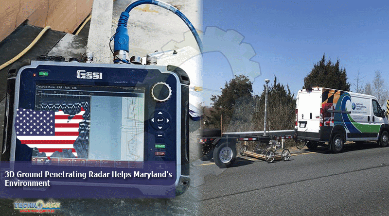
As an independent state agency with 850 teammates operating 1,000 environmental projects, the goal of MES is to protect Maryland’s environment through innovative solutions. One solution is its use of step-frequency three-dimensional ground penetrating radar (3D GPR) to help other agencies and organizations gauge the structural integrity of bridges and roadways, as well as determine the locations of a wide variety of buried features, including utilities, sinkholes, water main breaks and maintenance access locations.
Many industries use GPR as a vital component of their critical asset maintenance programs. The advanced capabilities of 3D GPR go beyond what traditional technologies offer. 3D GPR is a non-invasive, geophysical testing method that transmits and receives electromagnetic radar waves using a range of frequencies simultaneously. The reflections created by these radar waves produce a wealth of data for analysis, affording the end user enhanced flexibility to create complex deliverables that go beyond simply finding subsurface objects and anomalies.
Unlike older techniques that may require excavation and disruption to the surrounding ecosystem, 3D GPR analysis allows users to see subsurface conditions with extreme accuracy and clarity, with minimal environmental disturbance.
- “In addition to the environmental benefits, this technology produces significant time and cost savings over other methods,” said MES Senior Lead Environmental Specialist David Hollens.
- “3D GPR can be performed at a cost that is substantially less than other more invasive bridge deck analysis techniques, for example. This decrease in cost is due, in part, to the system’s modular and highly transportable design.”
The system can be operated at a range of speeds, reducing the need for complex lane closures and long-term roadwork setups, and preventing lengthy backups and delays to Maryland motorists.
Since becoming one of the first five U.S. organizations to purchase this technology, MES has scanned more than 1,100 bridge structures, equating to approximately 12 million square feet of surface area. Over the past five years, MES has acquired the field expertise necessary to efficiently and accurately use 3D GPR technology across multiple project disciplines.
Through this highly effective combination of technology and experience, MES provides cost-effective, noninvasive geophysical data collection services and private sector sub-consultant data analysis support to our clients. This fiscally responsible and innovative solution is creating opportunities throughout Maryland, while meeting the organization’s important environmental mission.
This news was originally published at bizjournals.com