
That haze in the air around the First Coat Friday is dust from the Sahara Desert.
The plume is over 2,000 feet wide and was sent on its way to us by a large cluster of strong thunderstorms that formed over the West African desert last week.
National Weather Service meteorologist Andrew Kennedy forsees an uncomfortable few days ahead for folks on the First Coast.
“We’re going to be in the mid to upper 90s. A couple of places could actually reach even a hundred degrees. And it’s going to be hazy, hot, humid and, yeah, lower rain chances than normal because of the dust,” he said.
Kennedy said the dusty conditions will be with us until Tuesday when we should see a return of the normal summer weather pattern with higher chances for rain.
In the meantime, he urges people with asthma or other upper-respiratory conditions to stay indoors as much as possible until the dust moves on.
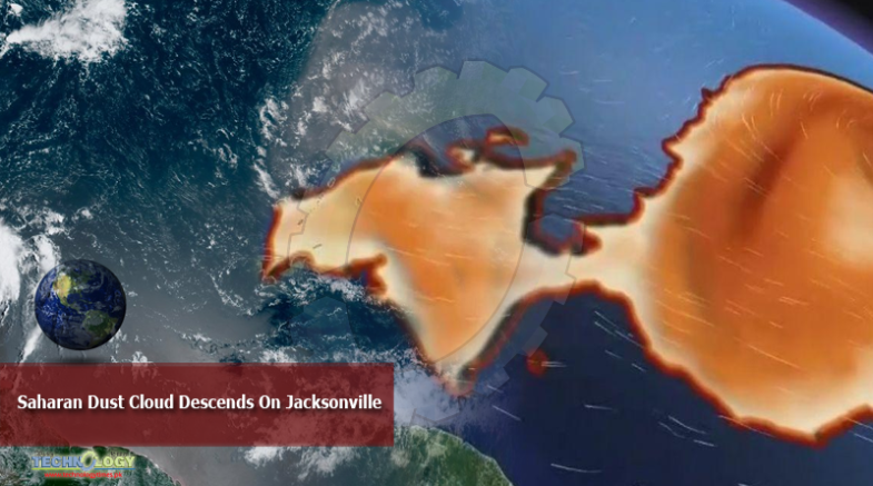
A massive cloud of dust from the Sahara Desert is arriving along the U.S. Gulf Coast this week after traveling across the Atlantic Ocean. The phenomenon happens every year – but the 2020 version is especially large and imposing, experts said.
The dust cloud is “quite large” this year, said Marshall Shepherd, director of the Atmospheric Sciences Program at the University of Georgia, in an interview on NPR’s All Things Considered. “I think that’s why it’s garnering so much attention.”
A large plume of dust from the Sahara Desert is enveloping the tropical North Atlantic and has the potential to reach the Sunshine State next week.
Originally Publish at: https://news.wjct.org/